Vostok Island (Vostok)
Vostok Island is an uninhabited coral island in the central Pacific Ocean, part of the Line Islands belonging to Kiribati. Other names for the island include Anne Island, Bostock Island, Leavitts Island, Reaper Island, Wostock Island or Wostok Island. The island was first sighted in 1820 by the Russian explorer Fabian Gottlieb von Bellingshausen, who named the island for his ship Vostok.
Vostok covers a land area of 24 ha. Its nearest neighbors are Flint Island, 158 km south-southeast; Caroline Atoll, 230 km to the east; and Penrhyn, 621 km to the west. It is 1.3 km in length, and is triangular-shaped.
Beaches on the island range between 25 and 30 m wide, composed of coral sand and rubble. There is no lagoon or fresh water on the island, and no known freshwater lens. Vostok's major portion is covered with a pure stand of Pisonia trees rooted in moist peat soil one meter thick. These trees, with heights of up to 30 m, grow so densely that no other plants can grow beneath them. The herbs Boerhavia repens and Sesuvium portulacastrum round out the known vegetation.
Coconut seedlings were planted on Vostok in 1922 and failed, although on the nearby islands of Caroline and Flint there are existing coconut palms.
Noteworthy fauna includes several species of seabirds, including the red-footed booby (Sula sula), great frigatebird (Fregata minor), lesser frigatebird (F. ariel), black noddy (Anous minutus), white tern (Gygis alba), masked booby (Sula dactylatra), brown booby (S. leucogaster) and brown noddy (Anous stolidus). The Polynesian rat and the azure-tailed skink (Emoia cyanura), together with coconut crabs and green turtles, completes the known land fauna.
Map - Vostok Island (Vostok)
Map
Country - Kiribati
 |
 |
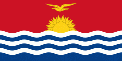
| Flag of Kiribati | |
The islands' spread straddles the equator and the 180th meridian, although the International Date Line goes around Kiribati and swings far to the east, almost reaching 150°W. This brings Kiribati's easternmost islands, the southern Line Islands south of Hawaii, into the same day as the Gilbert Islands and places them in the most advanced time zone on Earth: UTC+14.
Currency / Language
| ISO | Currency | Symbol | Significant figures |
|---|---|---|---|
| AUD | Australian dollar | $ | 2 |
| ISO | Language |
|---|---|
| EN | English language |


